


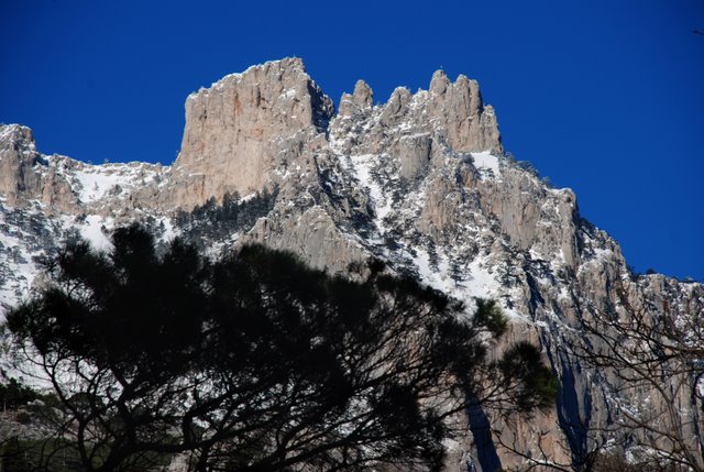
Ai-Petri mountain, the "Taraktash" Trail
The "Taraktash" Trail
starts from the most popular Crimean plateau "Ai-Petri" (St. Peter). You can get to the famous Ai-Petri cliffs (1234 m above sea level) by cable-car, car or minibus. The
mountain road is twisty but very beautiful.
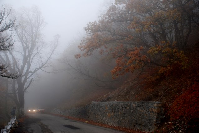
You can see the coastline and
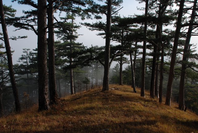
The trail goes through the pine-tree forest.

The route
of this excursion begins from
In the
beginning of the excursion there is
Admire the
sea on the left. Each sea on the Earth has its own color which depends on salt
content and on the weather. Maximum depth of the
By the way,
this name appeared in times of
Nowadays
the
Along the
entire Southern coast, to the right from the highway, there is a high mountain
ridge – the Main Ridge of Crimean Mountains. This relief forms the nice
climate. The Southern coast is protected from cold northern winds by Crimean
mountains. Coniferous and deciduous forest which covers the slopes of the Main
Ridge clean the air and saturate it with oxygen and volatile production – the
curative flying substances. The sea air also brings health. So, the main
generators of the curative climate of the
In front of
you above the woody hill a note is seen, like «HOLLYWOOD», - "ZOOLOGICAL
GARDEN”. In the distance on the slopes a waterfall is noticeable. To the right
the road goes to the private zoo "
Ahead there
is another crossroads where we turn to the Yalta-Bahchisarai road (Bahchisarai
is a former capital of Crimean Khanate).
We continue driving along the Yalta-Bahchisarai road, on which we will
cover more than
Firstly the
road was laid only from
The engineer-colonel
S.I. Shishko constructed the first urban water supply in
Now we will
make our first stop near Uchan-Su waterfall. It is full-flowing in spring and
after the rains, and in summer there is almost no water. It is one of the
highest in
The
waterfall makes river with same name which runs through forest and vineyards
and flows into the sea near "Oreanda” hotel.
An
interesting fact: in June
Name
Uchan-Su means "Flying water” from Turkic, the Greeks called it
"Kremasto-Nero”, what means "black water”.
In the
middle of the waterfall, between the cascades there is a water intake (a small
box with a sculpture of eagle). Water comes by a wide pipe to the Mogabi
reservoir.
Below the
waterfall there is a separate rock with the remains of defensive wall on its
western slope. It was one of the medieval fortresses (isars).
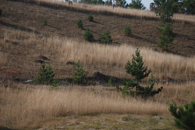
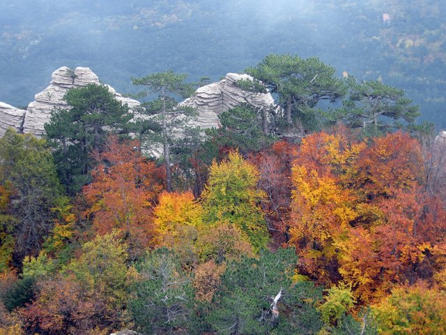
We are
driving on the slopes of Mogabi mountain in the pine-tree forest. The forest of
oak, beech, pine-tree occupy almost 95% of the nature reserve. Only separate
glades and areas on the plateau are forestless. The flora includes 1100 species
of plants, 90 of them are endemics. Here you can also meet giant trees. They
are oak, gew, alder, pine-tree, basswood.
In the
forest reserve live such animals as deer, roe deer, mountain fox, badger, and
other mammals (39 species). Here were acclimatized moufflon from
To the left
you can see the "Forester’s mushroom”. Next you can notice a section of
landslide which bended the pine-tree trunks. In 1964 this part of forest and
the Uchan-Su waterfall were declared as nature monument of local
importance.
On your
right you can see a row of big gews and a former house of road keeper. This
place is called Pendikul because the rock with this name is nearby.
Soon we will
see a sign "Silver pavilion” which is located on the Pendikul rock (altitude
The air in
pine-tree forests is fragrant because of flying substances- volatile production
which exterminates the pathogenic bacteria. The curative effect of walking in
the pine-tree forest was used by a famous Russian doctor Sergey Petrovich
Botkin for treatment. He ordered to build a summer palace for the empress Maria
Alexandrovna, the wife of the emperor Alexander II.
Nowadays
such treatment is called "torrenkur” – measured walking, climate therapy while
walking along the mountain paths.
Three
Russian emperors traveled along this road: emperor Alexander II, emperor
Alexander III and Nikolay II.
What is
Ay-Petri? It is hard to answer this question shortly. Somebody tells about the
beauty of the sunrise. Alpinists and climbers, tourists and excursionists,
speleologists and skiers will tell something different about this mountain.
Ay-Petri is
a peak and large mountain massif with area of more than 300 square kilometers,
one of the mesas along the Southern Coast which form the Main Ridge of Crimean
mountains. Ay-Petri massif stretches from east to west on
The
altitude of this mountain is
Two powers,
sometimes opposite, influenced the massif: inner (endogenous) and outside
(exogenous). First is the result of complicated physicochemical processes deep
in the Earth, resulting in slow sinking or rising of separate parts of the
earth's crust. Second is the result of the influence of climate and water on
the rock.
The
geological history of the Mountainous Crimea and Ay-Petri as its part is known
from the end of Triassic period (about 200 million years ago) when the
territory of modern
During the
last 200 million years the part of land where now Ay-Petri is, many times rose
above the sea and dipped into the sea. The depth of dipping varied, and
depending on it silt or sand were deposited, and in future they formed
compacted clays or sandstone, or chalky silt, which formed limestones.
Sometimes, the earth was washed away, and a lot of stones were drift to the
basin. Cemented with sea deposition, it formed conglomerates.
The rocks
of Ay-Petri peak differ from the main massif. There is a solid, firm limestone,
it has no layers. But somewhere there are interesting fossils – corals. The
peak is a big coral reef. Corals live in the sea on small depth, but the
thickness of the Ay-Petri massif is more than
The
Ay-Petri plateau is around. You see a tourist base and a restaurant. On the
opposite side of the road there is an old building of weather station. It was
built in 1805 as a branch of Pulkovskaya observatory.
An unusual
construction is a globe on the granite ground. It is so-called "Ay-Petri
meridian". Its geographical coordinates are exactly defined: 44°28' of northern
latitude and 34°05' longitude to the East of Greenwich.
To the
right from the road there is a monument to the partisans of the
Not far
from the monument, on the Shishko rock, there is a sightseeing area named in
honour of the constructor of the road. Its altitude is
If you turn
back to the slope, in front you see the Ay-Petri plateau. The teeth are on your
left. On the north-east there is Bedene-Kur mountain.
Not far
from Shishko rock there is a small, made before the revolution, condensation
water spring. On the Ay-Petri plateau there are much destroyed walls. Such
walls were made in the beginning of XX century for snow keeping (the snow
wasn’t blown down from the plateau, it melted slowly and filled water
resources). First walls on the plateau appeared, according to historians, in
the medieval times for land dividing.
The
Ay-Petri plateau as well as all the rest is a region of classic karst. Water
destroys the rock, making holes and grottos. The biggest cave in this region is
called Kaskadnaya.
Not far
from the rope road there is a cave equipped for tourists which is called "Three
Eyes” because of 3 holes-entrances. In winter a lot of snow accumulates here,
and because of low temperature ice preserves here even in summer.
You can
receive evidence in the contrast of Ay-Petri climate, if you ascend from
Precipitation
on the Ay-Petri plateau falls out as rain (40% from all the precipitation) and
snow (60%). Rains are frequent during the period from November till March. The
stable snow cover is from the middle of December till April. This period is
good for skiing. But sometimes snow can melt even in winter.
In January,
February and in several years March the avalanche danger is serious.
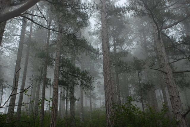
Relative
humidity in the mountains is higher than on the seacoast. Fogs are more
frequent on the plateau. The wind in the mountains is much stronger sometimes
it reaches
Near the
Near the border
of the plateau there is a pine-tree "aircraft”. Its age (about 300 years) and
interesting form of crown made it a separate monument of nature.
Of great
interest are several very old gews on the glade to the NE from Ay-Petri teeth.
The age of the oldest one is more than 1000 years. In past, gews were common
distributed in the mountains.
We come
back by the ropeway "Miskhor- Ay-Petri” which is a unique construction and one
of the brightest places of interest in
The ropeway
was constructed in 1987 year. Its upper section which is
The ropeway
has 4 cabins, 2 on each section. It works as pendulum: two cabins move at the
same time to each other, meet in the middle of the section and pass in the
opposite directions. The cabin is about 1.5 t and contains up to 35 people.
From the
lower station we can return to

